How to use the OSM Paths Overlay
This overlay adds paths from Open Street Map (OSM) to any topo map. They're really useful for route planning, to see what footpaths might exist that are not on the map.
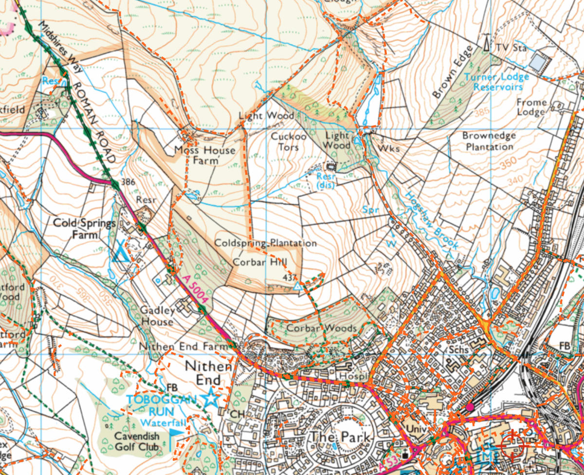
For example, here's Buxton in the UK on an Ordnance Survey map. The official paths are in green with the OSM overlay paths added in orange. It turns out there's many more ways out of the north of Buxton onto the moor than shown on the map!

The OSM paths can be more accurate than those on maps, because they are surveyed regularly by the OSM community. They often better show where a path is on the ground if the path has moved over time.
However, not every footpath is included in OSM. They are missing a fair few, especially in less frequented areas.
If you want even more information about where a footpath is, use the Satellite Spy to see what the satellite map shows.
More Info
This overlay is constructed by querying the Overpass API for the following features:
- way[highway=track]
- way[highway=path]
- way[highway=footway]
- way[highway=steps]
- way[highway=bridleway]
The query is done for the entire screen area. If your screen area showed all of the UK, this would generate a huge query with far too many results. To avoid this the overlay is automatically hidden as you zoom out.
Generally this works OK because this overlay is most useful when zoomed in on a map doing detailed planning in an area.